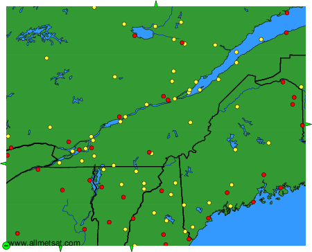
METAR-TAF
공항 :
Sainte-Clotilde-de-Châteauguay
퀘벡
순록
가티노
오타와
뱅고어
베를린
벌링턴
콩코드
그린빌
워터빌
몬트리올
플리머스
오거스타
로체스터
맨체스터
포츠머스
포틀랜드
스프링필드
트루아리비에르
몬트리올 트뤼도
Barre / 몬트필리어
오번 / Lewiston
몬트리올 Mirabel
Baie-Comeau
Bar Harbor
Beauceville
Beauport
Cap Tourmente
Chamouchouane
Charlevoix
Clayton Lake
Deschambault-Grondines
Franklin County
Frelighsburg
Frenchville
Fryeburg
Glens Falls
High Falls
Houlton
Ile-aux-Grues
Ile Bicquette
Île d'Orléans
Ile Rouge
Jonquière
Keene
La Baie
La Baie
L Acadie
Lac-Jacques-Cartier
Laconia
La Pocatière
L'Assomption
La Tuque
Lebanon
Lennoxville
Lyndonville
Massena
Millinocket
Mistook
Mont-Joli
Mont-Tremblant
Morrisville
Mount Washington
Newport
Nicolet
Normandin
Onatchiway
Parent
Plattsburgh
Pointe Claveau
Presque Isle
Rivière-du-Loup
Roberval
Rockland
Rome
Rutland
Saint-Anicet
Sainte-Anne-de-Bellevue
Sainte-Clotilde-de-Châteauguay
Sainte-Foy
Saint-Hubert
Saint-Léonard
Sanford
Saranac Lake
Sherbrooke
St. Johnsbury
Trois-Rivières
Valcartier
Varennes
Whitefield
Wiscasset
퀘벡, 남
퀘벡
연해주
뉴잉글랜드
펜실베이니아
온타리오, 남
Sainte-Clotilde-de-Châteauguay, 퀘벡, 캐나다 위도: 45-10N, 경도: 073-41W, 고도: 52m
현재 날씨관측 예보는 54 분 전, 05:00 시(UTC)에 발표되었습니다.
서남서 풍 6 kt
온도 10 °C
습도 57 %
기압
METAR: CWIT 190500Z AUTO 25006KT 10/02 RMK AO1 SLP276 T01010024 51006
시각: 00:54 (05:54 UTC) TAF: 누락
4,000개 이상의 공항 관측 자료 및 예보 (METAR 및 TAF 보고).